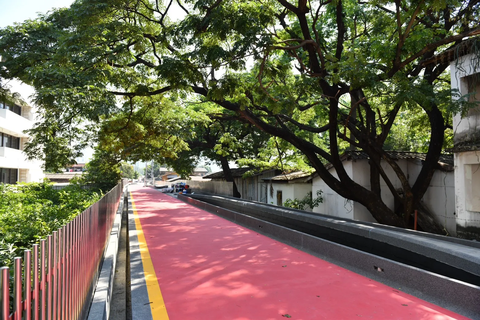
In a city famous for traffic, skyscrapers, and nonstop movement, one of Bangkok’s most surprisingly peaceful experiences floats quietly above the chaos. Hidden between two of the capital’s most important green spaces is a long elevated walkway known locally as the “Green Bridge” or “Green Mile,” a pathway that connects Lumphini Park and Benjakitti Park through the heart of the city.
At first glance, it sounds simple: just a pedestrian bridge linking two parks. But in reality, the Green Pathway has evolved into one of Bangkok’s most unique urban experiences. It is part jogging track, part hidden skyline walk, part cycling route, and part social observation deck into the everyday life of Bangkok. Walking here feels strangely disconnected from the city below while still being deeply inside it.
The contrast is what makes it unforgettable. One moment you are surrounded by glass towers and luxury condos, and the next you are passing old canal-side homes, local food stalls, small communities, churches, mosques, and hidden neighborhoods many tourists never realize exist. Bangkok suddenly feels layered in a completely different way.
A Hidden Route Above Bangkok
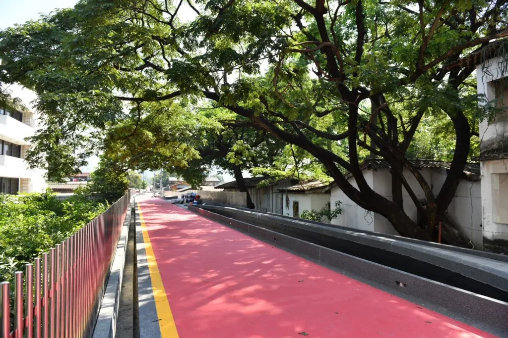
The Green Bridge stretches approximately 1.3 to 1.6 kilometers depending on the route connection and expansion sections. Originally constructed in 1999, the elevated path was designed to connect Lumphini Park and Benjakitti Park together as part of Bangkok’s growing green-space strategy.
For years, the bridge remained somewhat forgotten. Locals used it mainly for jogging or cycling while many tourists never even knew it existed. But after the massive expansion of Benjakitti Forest Park and recent renovations by the Bangkok Metropolitan Administration, the pathway has transformed into one of Bangkok’s most interesting urban-walking experiences.
Today, the route acts like a green artery connecting Sukhumvit, Silom, and central Bangkok together without needing to touch the city’s traffic-heavy roads.
The Walk Feels Like Discovering a Secret Bangkok
What makes the Green Pathway special is not just the parks at either end. It is the journey itself.
Starting from Lumphini Park near Wireless Road and Soi Polo, the elevated walkway slowly rises above street level before weaving across neighborhoods most people only ever pass by in taxis.
From above, Bangkok looks completely different.
You can see old wooden homes packed tightly beside canals while luxury towers rise dramatically behind them. Small local restaurants send cooking smells upward toward joggers and cyclists. Community mosques and churches sit only meters apart. Tiny alleyways branch endlessly beneath the bridge while expressways roar nearby in the distance.
The Green Pathway somehow exposes the real texture of Bangkok. Not the polished version shown in advertisements, but the actual layers of the city existing together at once.
One of the most fascinating parts of the walk is how quickly the atmosphere changes. Near Benjakitti, the city feels futuristic and modern. Near Lumphini, the route feels more local and residential. The bridge becomes less of a transportation link and more of a moving observation deck into Bangkok life itself.
Benjakitti Forest Park Changed Everything
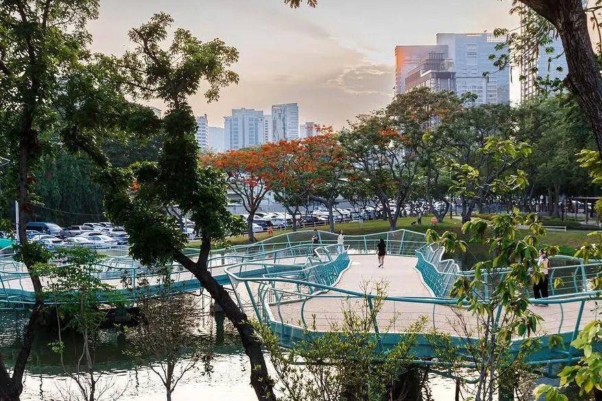
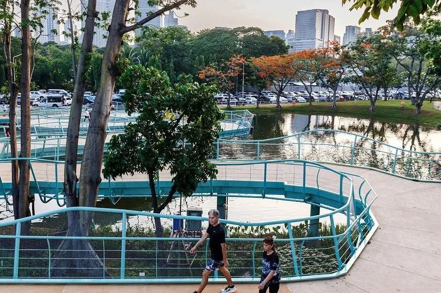
The expansion of Benjakitti Forest Park in 2022 completely changed how people experience the Green Pathway.
Before the expansion, the bridge was mostly known among runners and cyclists. But once Benjakitti Forest Park opened with its wetlands, skywalks, elevated cycling lanes, and huge green landscape, the pathway suddenly became part of one of Bangkok’s most ambitious urban nature projects.
Now, many visitors begin their journey inside Benjakitti Forest Park itself before transitioning directly onto the Green Bridge toward Lumphini Park. The experience almost feels like walking through a continuous green corridor floating across Bangkok.
The skyline views became one of the biggest attractions too. In several sections, the elevated path sits high enough to reveal dramatic views of Bangkok’s skyscrapers rising above trees and canals simultaneously. During sunset or after rainstorms, the scenery becomes especially cinematic.
A Favorite Spot for Bangkok’s Running and Cycling Community
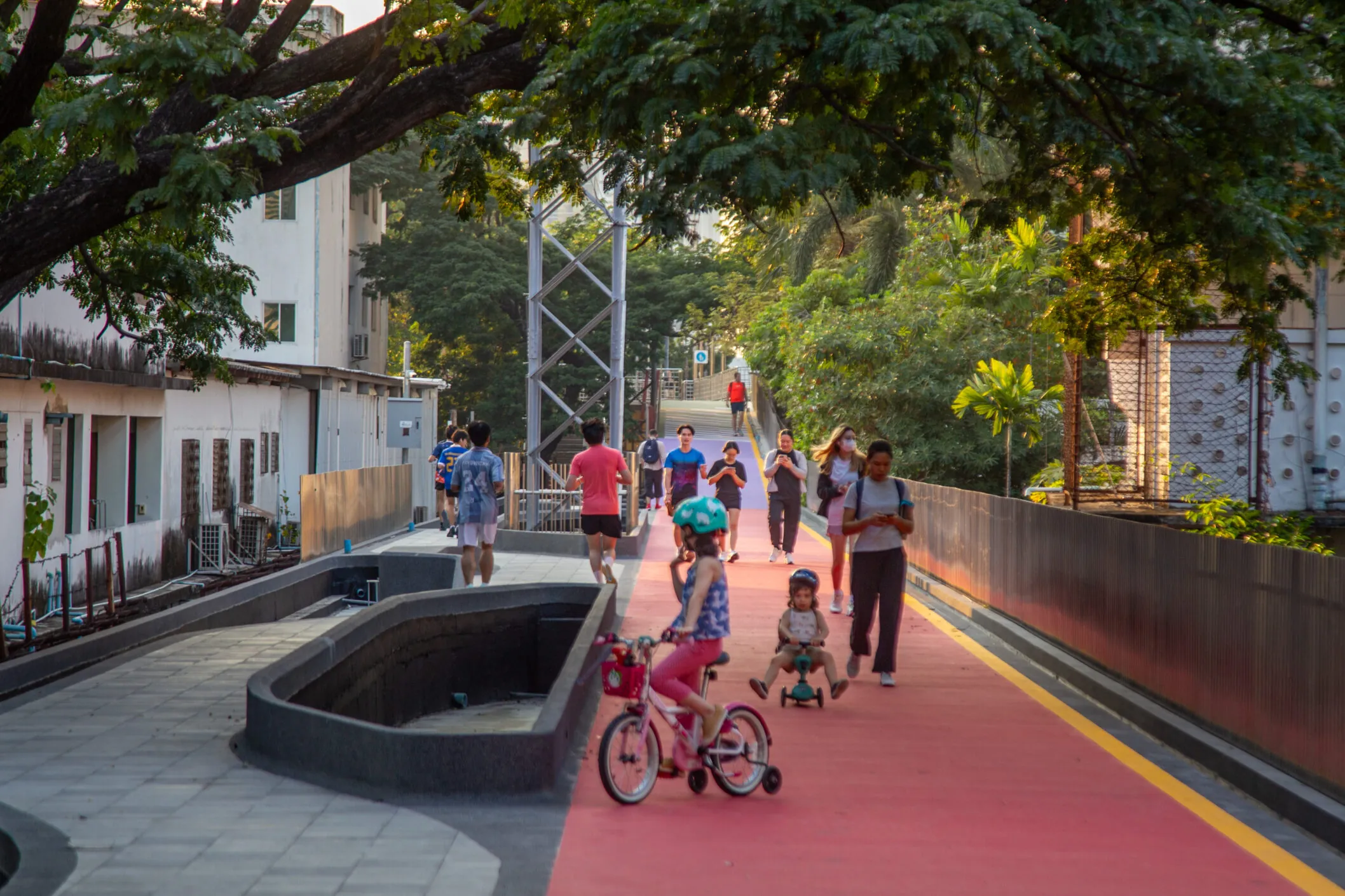
The Green Pathway has also become deeply integrated into Bangkok’s fitness culture.
Joggers frequently use the route to combine Lumphini Park and Benjakitti Park into one enormous running circuit. Cyclists use it as a safer car-free route through central Bangkok. During early mornings and evenings, the bridge becomes filled with runners, walkers, photographers, and people simply escaping the city’s traffic for an hour.
Unlike many urban exercise routes, the pathway feels surprisingly peaceful despite sitting in the middle of Bangkok. The elevated design removes much of the noise and stress from the streets below.
At sunset, the atmosphere shifts again. Couples walk together, photographers stop for skyline shots, and locals casually sit along the route enjoying evening air after work. The bridge starts feeling less like infrastructure and more like a public social space.
Recent Renovations Are Transforming the Walkway
In recent years, Bangkok Metropolitan Administration has heavily renovated the Green Bridge to modernize safety and accessibility. Major upgrades include improved lighting, CCTV systems, cycling lanes, granite walkways, ramps replacing steep staircases, and better accessibility features.
Parts of the renovated pathway officially reopened in 2025 and 2026, with additional improvements expected to continue through mid-2026.
The renovations also helped transform the bridge visually. Its bright green design and cleaner infrastructure gave rise to the popular “Green Mile” nickname now widely used by locals and content creators.
Bangkok’s Urban Future Feels Visible Here
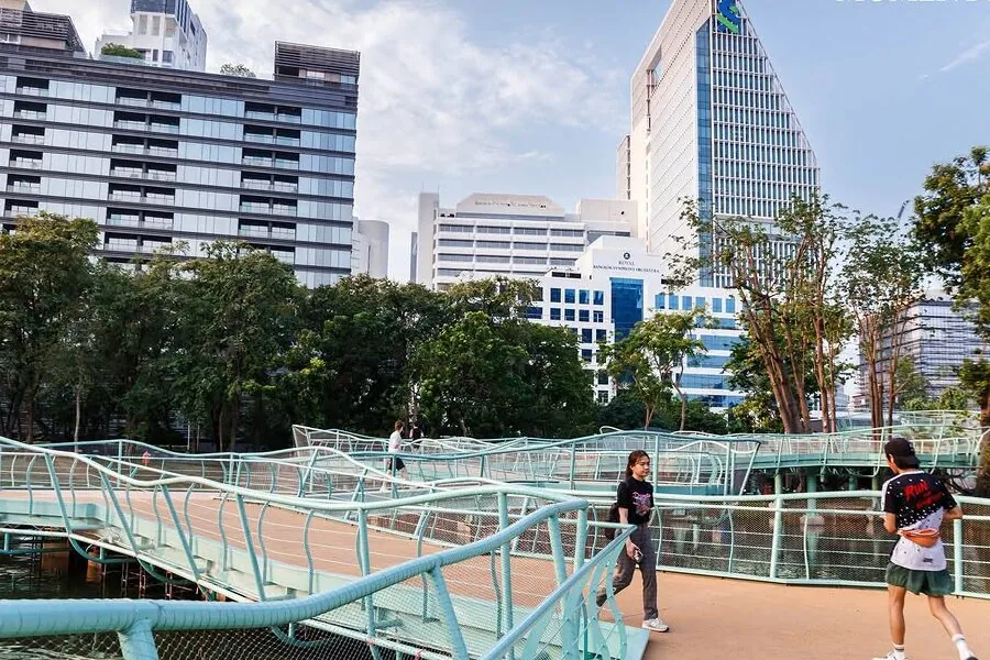
More than anything, the Green Pathway represents a different vision of Bangkok.
For decades, Bangkok developed around cars, roads, and expressways. But this elevated green corridor quietly shows another possibility: a more walkable, connected, human-centered city where green spaces are not isolated islands but linked together into continuous public environments.
It is one of the few places in Bangkok where you can genuinely walk long distances through the city while staying surrounded by greenery almost the entire time.
And perhaps that is why the Green Pathway feels so special. It does not remove Bangkok’s chaos. Instead, it floats gently above it, allowing you to see the city more clearly.
FAQ
What is the Green Pathway in Bangkok?
It is an elevated pedestrian and cycling walkway connecting Lumphini Park and Benjakitti Park through central Bangkok. It is also commonly called the Green Bridge or Green Mile.
How long is the Green Bridge?
The pathway is approximately 1.3 to 1.6 kilometers long depending on the route section and park connections.
Is the Green Pathway free to enter?
Yes. The walkway is completely free and open to the public.
Can tourists use the Green Pathway?
Absolutely. It has become increasingly popular among tourists, runners, photographers, and cyclists looking to explore a quieter side of Bangkok.
What is the best time to visit?
Early morning and sunset are the best times because temperatures are cooler and the skyline views become especially beautiful.
Is the pathway safe at night?
Recent renovations added improved lighting and CCTV systems to increase safety.
Can you cycle on the Green Bridge?
Yes. Dedicated cycling lanes exist along much of the route, especially after recent upgrades.